





Comprehensive geophysical investigation services delivering reliable subsurface characterization for engineering and infrastructure projets.
Accurate understanding of subsurface conditions is essential for safe and cost-effective project execution. Through advanced geophysical survey techniques, our team delivers detailed subsurface profiles that support geotechnical design, infrastructure development, and site investigations.
Our geophysical services combine modern equipment, experienced specialists, and advanced interpretation methods to provide dependable and actionable results.
What We Do
1. Electrical Resistivity Tomography (ERT) & Imaging
Electrical Resistivity Tomography (ERT) is used to characterize subsurface soil conditions by measuring variations in electrical resistivity. The inverted 2D-ERT sections provide clear imaging of soil stratification, groundwater conditions, weak zones, and subsurface anomalies.
ERT is particularly effective for:
- Identifying soil layering
- Detecting voids and cavities
- Locating groundwater zones
- Mapping subsurface heterogeneity
2. Seismic Shear Wave Velocity Measurements Using Multi-Analysis of Surface Waves (MASW)
The MASW method evaluates subsurface stiffness through shear wave velocity (Vs) profiling. The 2D MASW section characterizes subsurface strata with respect to Vs velocity, providing critical data for geotechnical and seismic design.
- MASW is particularly effective for:
- Soil-Bedrock Mapping
- Detecting voids and cavities
- Seismic Site Characterization
- Mapping subsurface heterogeneity
- Grouting Evaluation
- Compaction Evaluation
This method supports seismic site classification, foundation design, and ground improvement assessment.
3. Seismic Refraction
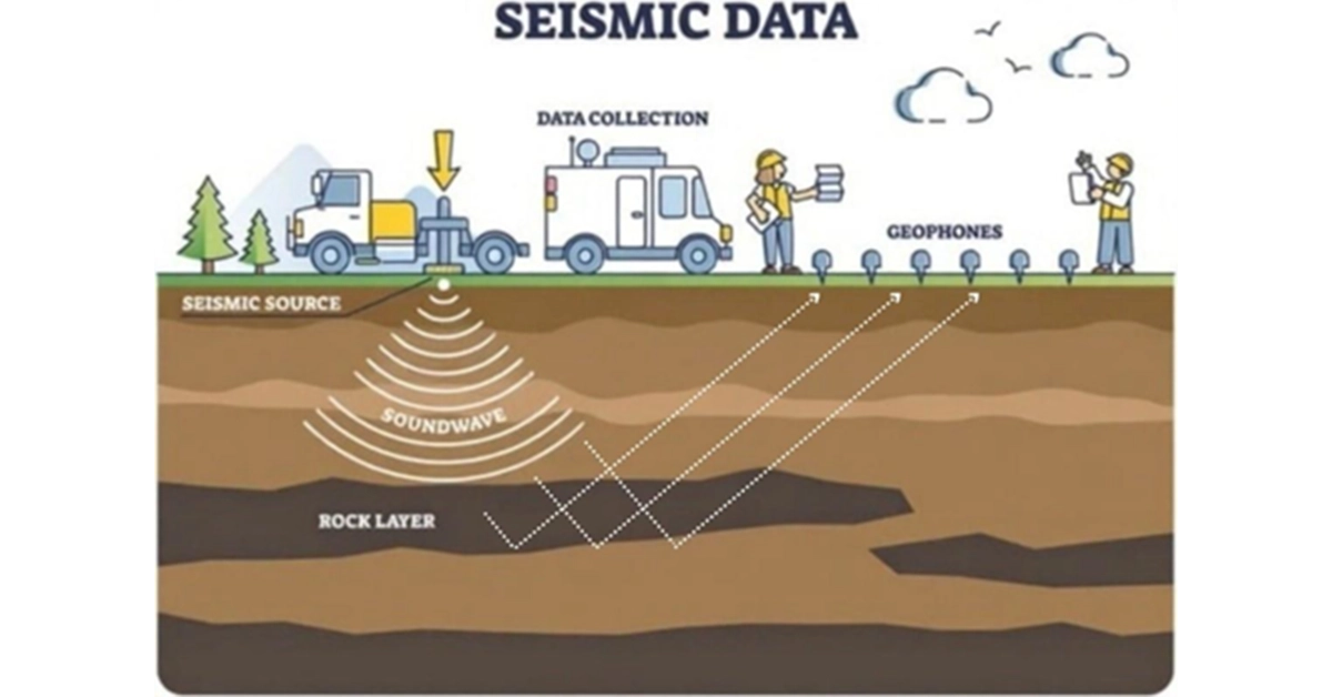
Seismic refraction surveys determine layer thickness, rippability, and depth to bedrock by analyzing refracted seismic waves. This technique is widely used for engineering site investigations and large-scale infrastructure projects.
4. Seismic Downhole & Crosshole Testing
Downhole and crosshole seismic testing provide highly accurate in-situ measurements of P-wave and S-wave velocities. These methods are essential for:
- Seismic site response analysis
- Soil dynamic property evaluation
- Critical structure design parameters
5. Ground Penetrating Radar (GPR)
Ground Penetrating Radar (GPR) produces high-resolution subsurface images for shallow investigations. Interpreted GPR data can identify:
- Buried utilities
- Voids and cavities
- Reinforcement and structural elements
- Subsurface anomalies
GPR is a fast and non-destructive method suitable for urban and infrastructure environments.
6. Gravity Surveys
Gravity surveys detect variations in subsurface density. They are commonly used for identifying voids, cavities, geological structures, and large-scale subsurface features.
7. Magnetic Surveys
Magnetic surveys measure variations in the Earth’s magnetic field to detect buried metallic objects, geological contacts, and subsurface structures.
About Wimpey Laboratories
Wimpey Laboratories is a leading independent provider of ISO-accredited testing and calibration services, backed by over 20 years of expertise. Leveraging advanced technology, it delivers accurate, reliable solutions that ensure safety, compliance, and customer satisfaction. Serving more than 9,500 clients across 49+ countries, Wimpey offers over 5,500 accredited services tailored to diverse industry needs.